Introduction
Using GCS Map
- Drag the map and zoom into your current location.
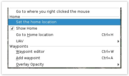
- Do a right click and select Set the home location from the context menu.
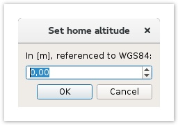
- Enter the WGS84 altitude in meters
About WGS84 altitude
The WGS84 altitude do not refers to the know altitude (usually MSL : Mean Sea Level) of a location but take in account others parameters like the Geoid separation:
Altitude (WGS84) = Height (MSL) + Geoid Separation
Altitude (MSL) can be found using GoogleEarth or other map tools and Geoid separation can be obtained here.
So not a easy way, if you only know your altitude without the Geoid separation values, just enter Altitude. This should not be an issue and sufficient for sensor calibration.
Using GPS data
This is the normal method of setting the Home Location, you should set the Home Location every time you want to use autonomous features or Return to base.
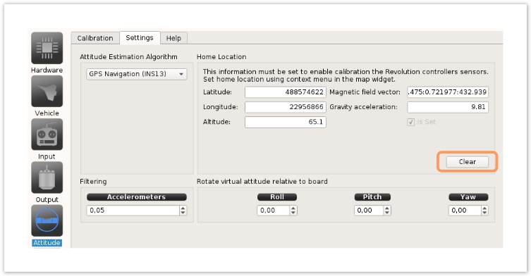
Go into the Configuration > Attitude and select the Settings tab.
- Hit the Clear button and wait until the Home Location remain defined again.
- Save settings using the bottom-right Save button.
Automatically set Home Location
If you plan to use you vehicle next day in another location, you should set the HomeLocation > Set parameter to False
This means the next time the controller start and get a good GPS fix, this new location is taken in account.
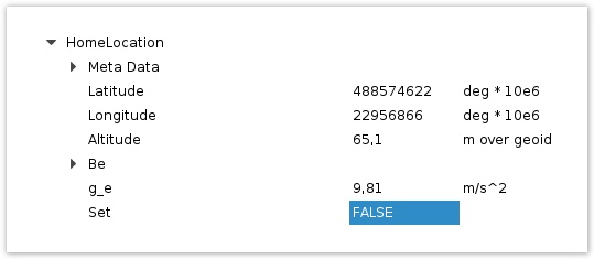
In System tab and UAVOBrowser, search for HomeLocation Uavo, change the Set parameter to FALSE and Save settings.